Here are the images from a morning romp (started at 0430) to a new location I wanted to try out in Chelsea. I wandered around in both the car and on foot with GuynS looking for an ideal place to capture some neat shots.
Although they aren't my favourite shots ever ... here they are! Use the arrows to scroll through all of the images of the shoot.
Showing posts with label landscape photography. Show all posts
Showing posts with label landscape photography. Show all posts
Sunset HDR's at the Refuge Tetras
I've been catching up a lot on the HDRs from the trip this time and half to go back to the first night sunset. Here are a few from that evening ...


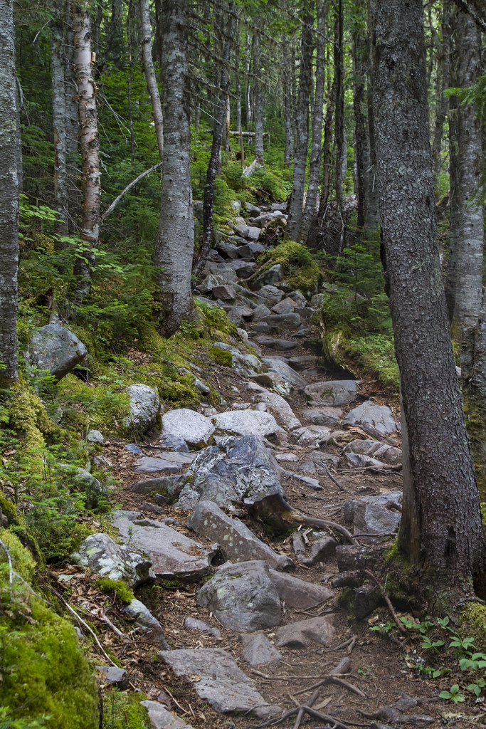
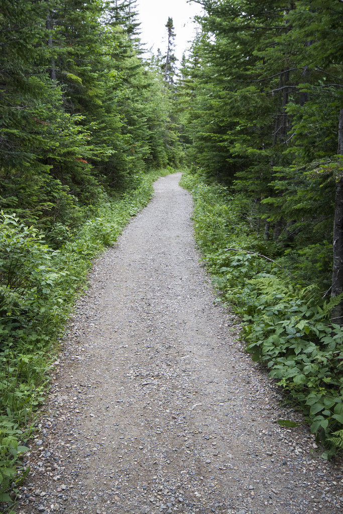
Different paths on the same day
One of the things I found extremely amusing was the drastic changes possible between walking paths that we experience throughout the hike. Here is a very specific example of the change in paths within a period of no less than a half an hour. The first image below is the trail that we had to hike in the woods descending from the Xalibu lookout and to the cabin below that I pointed out in previous images. The second one is the trail that was directly following that same cabin. Slight difference.
Up to Mount Xalibu
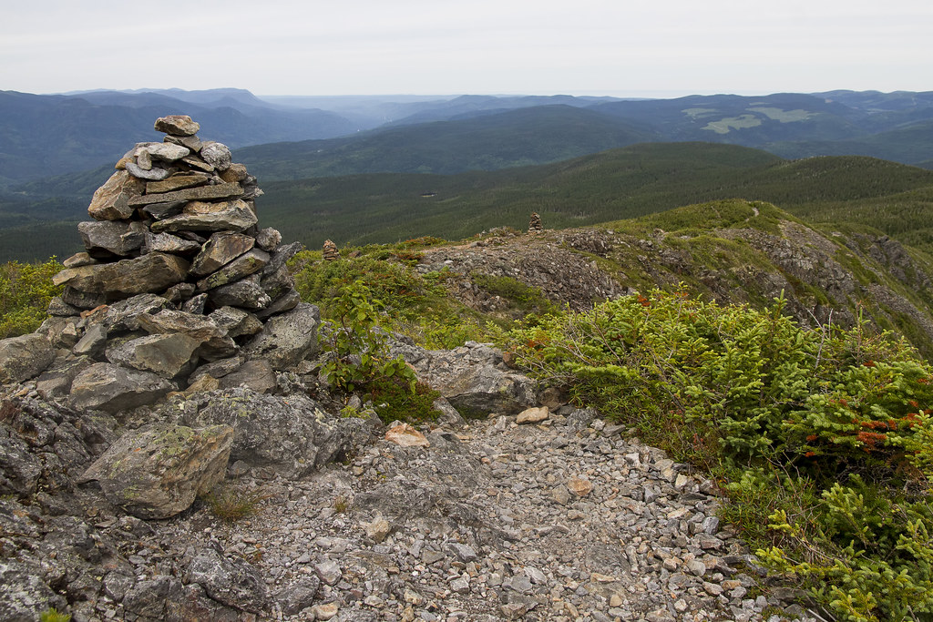
After looking off the lookout I showed a couple of posts ago, believe it or not, we had to keep climbing in order to go down. We figured the 'sketchy Inukshuk paths' were finished, but alas, this was not the case. Here was the path heading up:
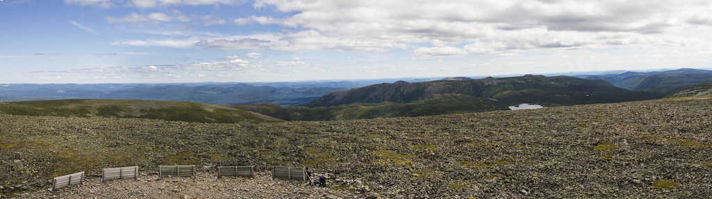
Here is a link to a panorama of the top of this peak, Mount Xalibu. Zoom in using the "+"/"-" buttons on the bottom right and then scroll around to your hearts content!
http://zoom.it/Afgo
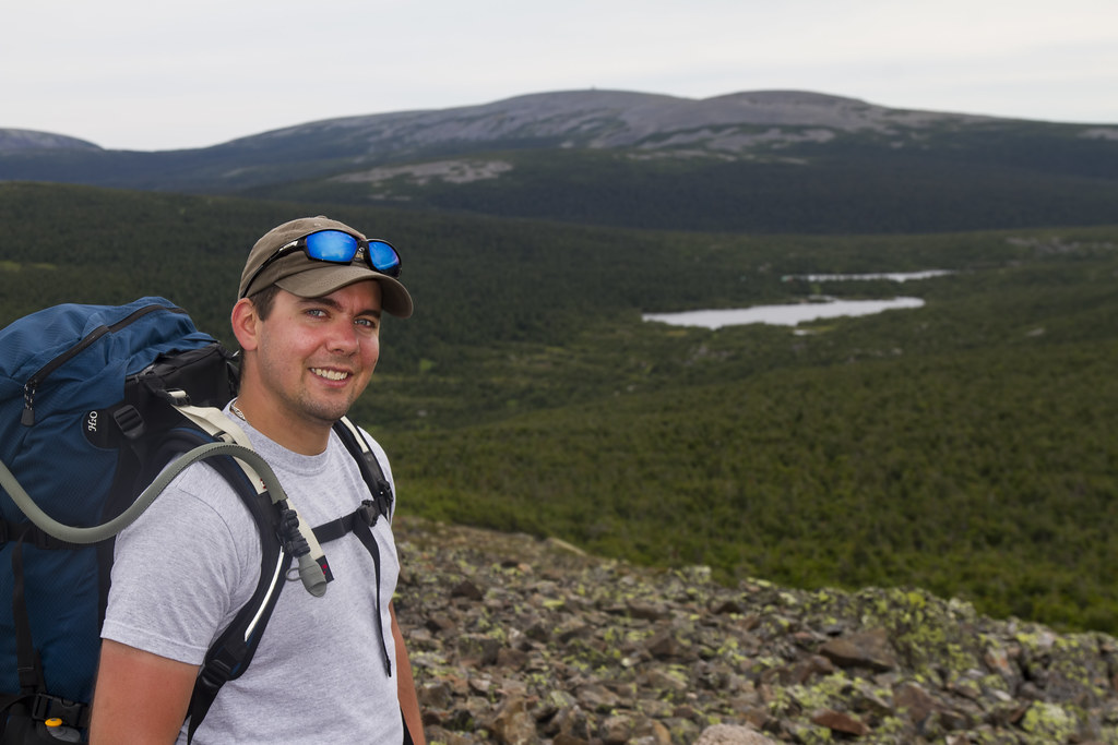
Here is a quick 'hero shot' from the top of the peak with Marc and the great view in the background.
And finally ... look at the path to head down!
Here is a link to a panorama of the top of this peak, Mount Xalibu. Zoom in using the "+"/"-" buttons on the bottom right and then scroll around to your hearts content!
http://zoom.it/Afgo
Here is a quick 'hero shot' from the top of the peak with Marc and the great view in the background.
And finally ... look at the path to head down!
Parc national de la Gaspésie
A while back I was taking you through the first day of our trip in the Parc national de la Gaspésie
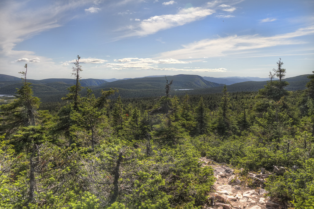
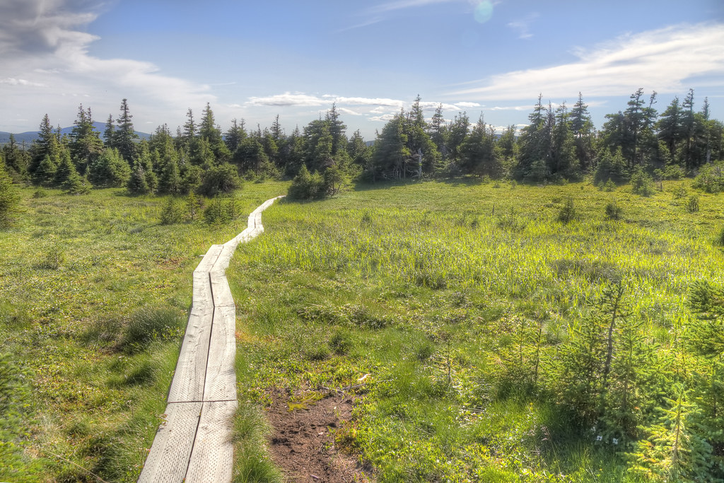
but I think that is where I left off. We had two more days of hiking on that trip, and consequently, two more days of images. The day started off with us still in the woods and some more wooden paths through them.

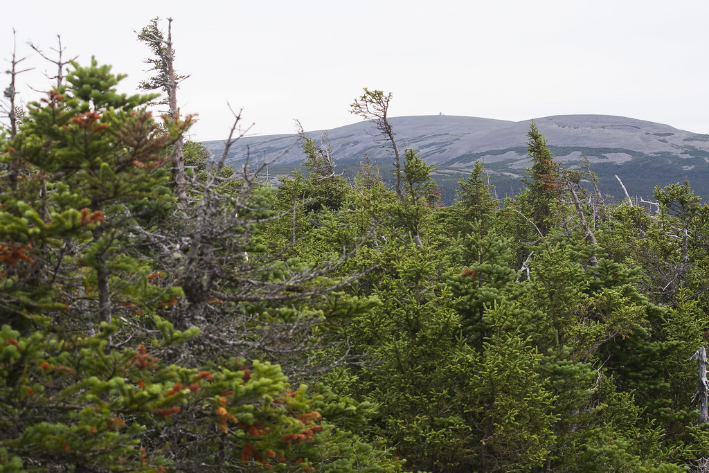
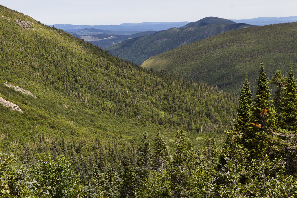
Since we were still in the woods, we had to make our way up and up and up and out of the woods, eventually to peak out over the trees. Looking back the way we came, we catch a glimpse of the lookout tower on the mountain in the background from where we came down the day before!
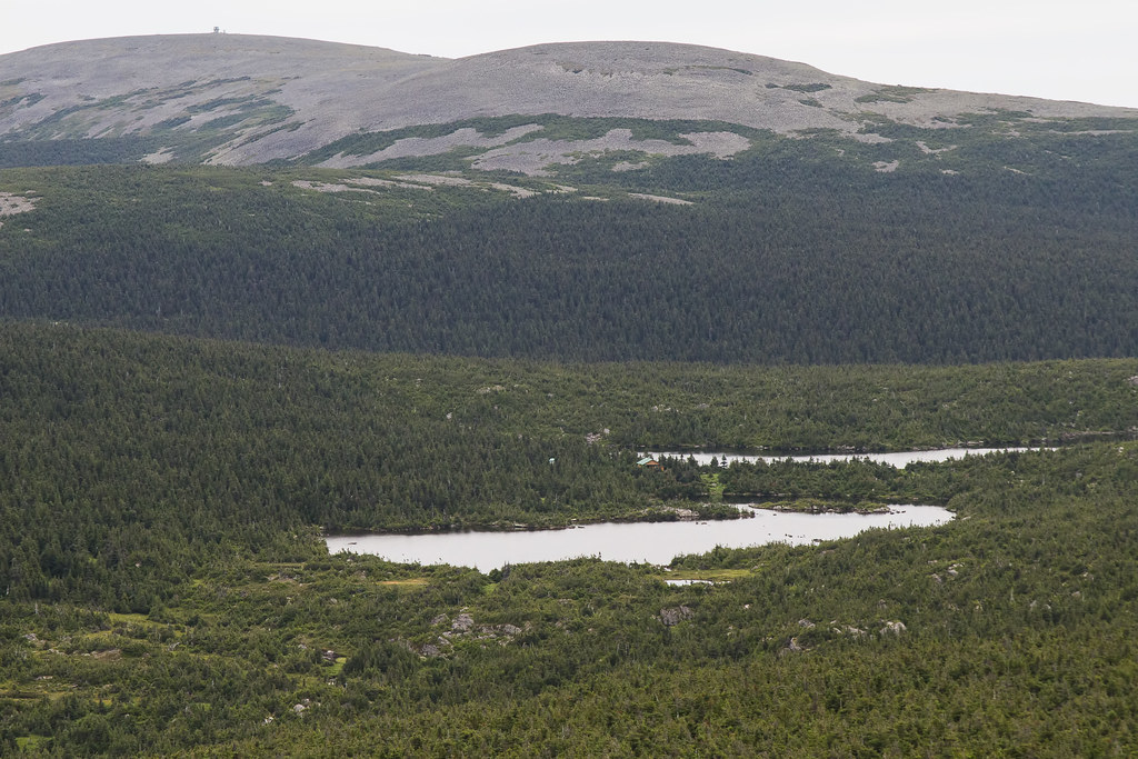
Finally popping up out of the trees completely we get a decent view, in that same direction, over top of the trees. The neat thing about this image is that we get a decent look at the physical shape of the two lakes and the refuge (green room in the middle of the two lakes) where we slept the night before AS WELL AS where is is in relation to the lookout tower from the previous day's hike (top left).
but I think that is where I left off. We had two more days of hiking on that trip, and consequently, two more days of images. The day started off with us still in the woods and some more wooden paths through them.
Since we were still in the woods, we had to make our way up and up and up and out of the woods, eventually to peak out over the trees. Looking back the way we came, we catch a glimpse of the lookout tower on the mountain in the background from where we came down the day before!
Finally popping up out of the trees completely we get a decent view, in that same direction, over top of the trees. The neat thing about this image is that we get a decent look at the physical shape of the two lakes and the refuge (green room in the middle of the two lakes) where we slept the night before AS WELL AS where is is in relation to the lookout tower from the previous day's hike (top left).
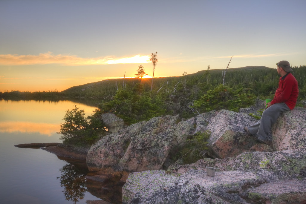
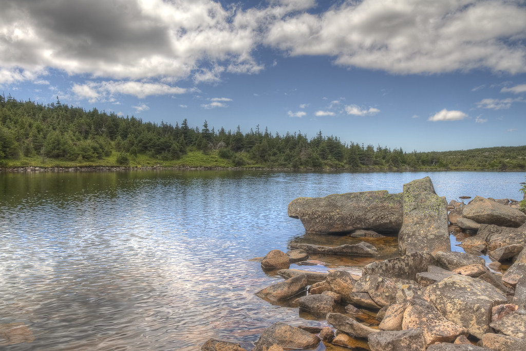
Refuge Tétras
Finally we arrived at the Refuge Tétras. This is a cozy cabin in the 'middle' of the park that in which you can reserve a bed. It holds up to 8 people and makes for a comfortable stopover at the end of a day of hiking. We arrived, put down our stuff, explored a little bit (particularly scoping out a spot for some sunset pictures later on) and sat down to eat. After eating we spent most of the rest of the evening watching the sun go down over the lake and the stars come out. Here are some images from in and around the Refuge that night. The first is of the lake beside which the Refuge is situated. The next ones are of the sunset (and the surrounding landscape including the cabin itself during the sunset). Finally, the last image is an Iridium Flare that we watched from the Refuge.


Between Mont Jacques-Cartier and the Refuge Tétras 2 of 2
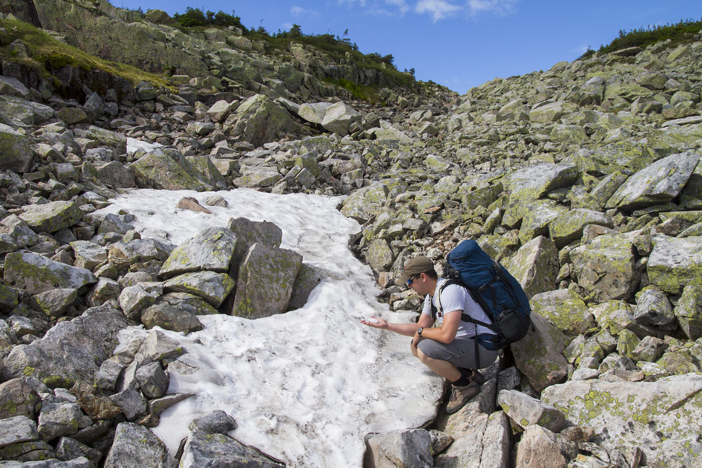
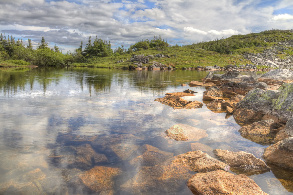
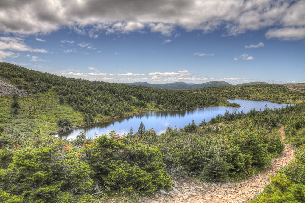
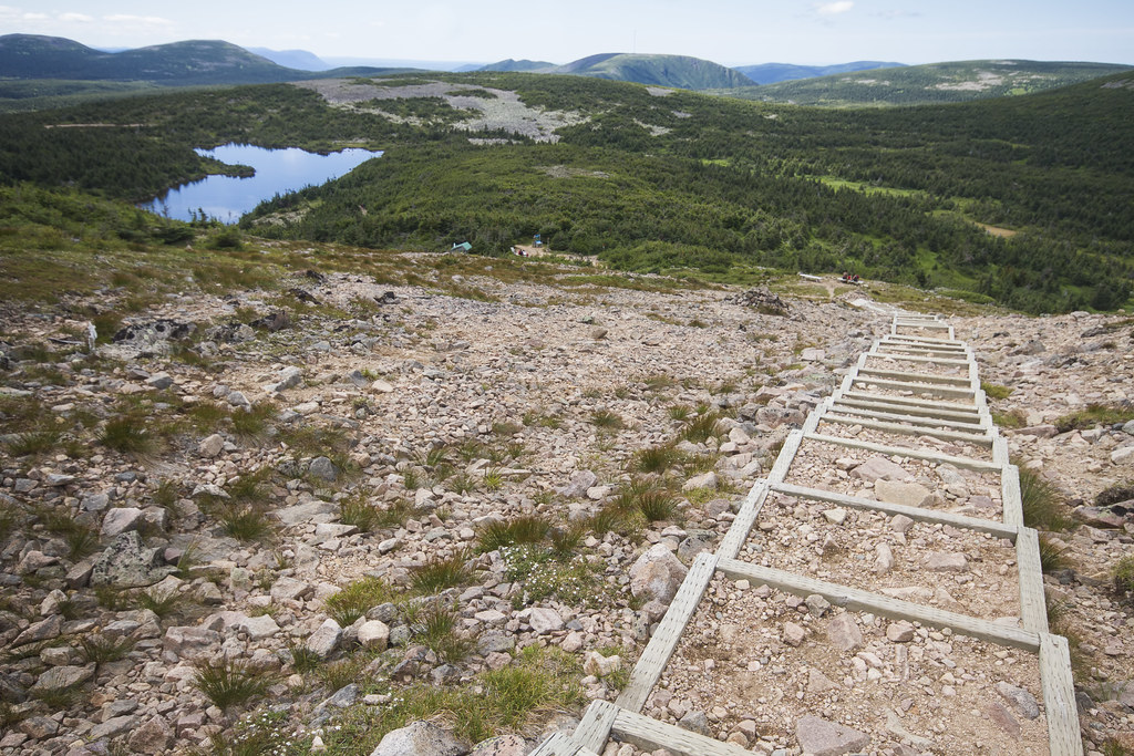
The path from yesterdays post was luckily not like that for the entirety for the entirety of the 5km between the Summit and the Refuge. Here are some of the other views from that trail (including a couple of much improved trails!) The first image showed some snow we came across on the path; a veritable Christmas in July (it in fact was July 25th). The second a little lake (Okay, a pond) right beside where the snow was. The third shows the path descending again below the treeline with a lake in the background. That lake is our destination and if you look really closely, you can see the green metal roof of the Refuge close to the lake in the middle of the trees. Finally, the last image is of a slightly improved path on the way to the Refuge.
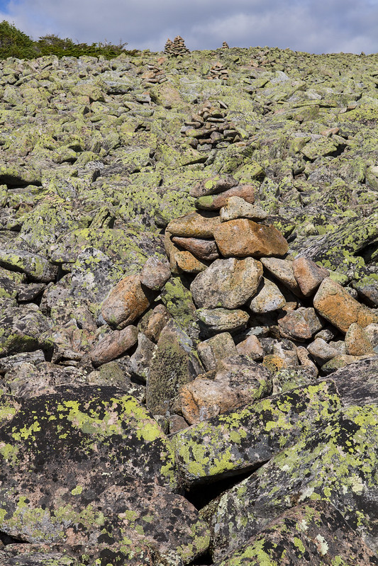
Between Mont Jacques-Cartier and the Refuge Tétras 1 of 2
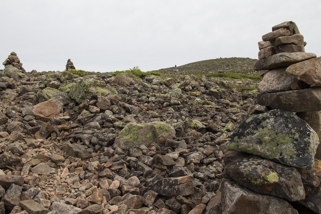
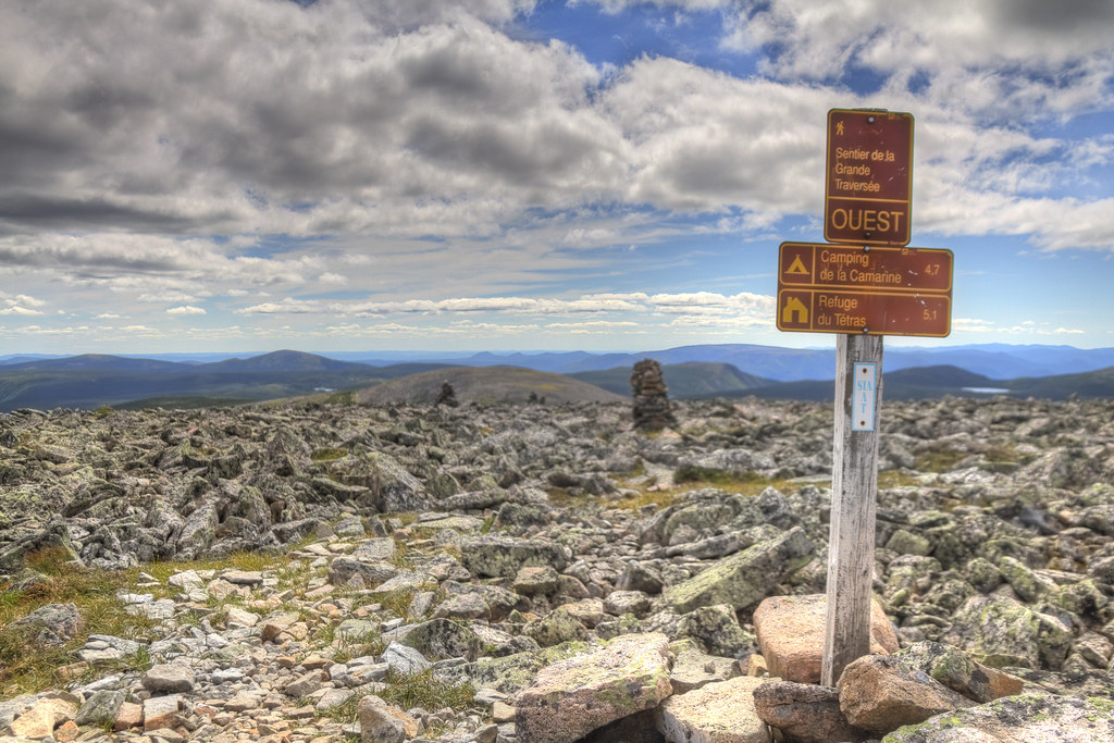
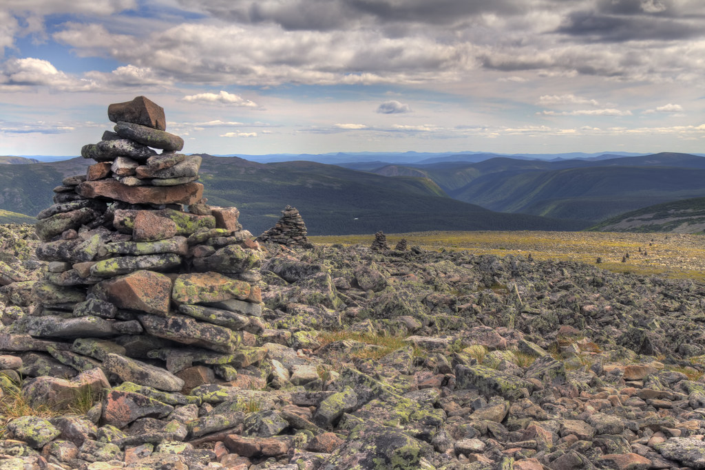
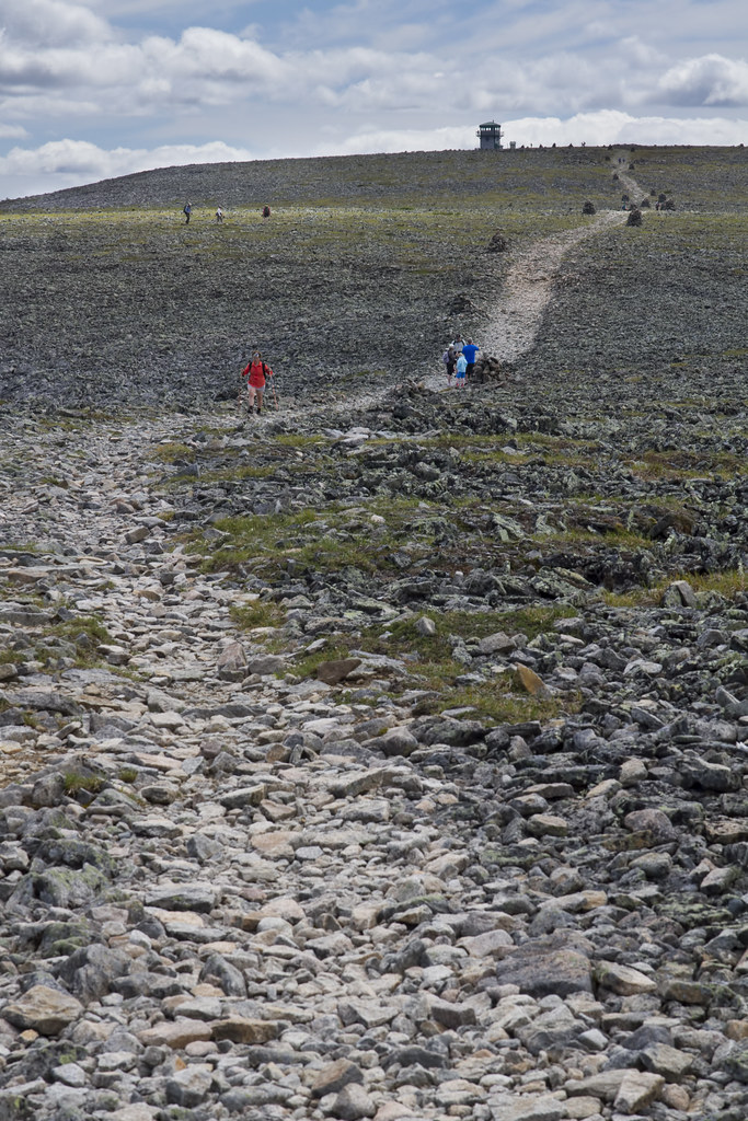
Since the next step of the journey that day was to make it to the refuge (Refuge Tétras) in which we were going to sleep that night, we continued on. Since there are several photo worthy spots and stories along this way, this chunk of the trip will be a double header! The most shocking thing about this next part was leaving the summit of Mont Jacques-Cartier. By this I mean that we left the well groomed, well maintained and oft traveled path to the summit and started on its polar opposite (for the first bit at least). As soon as we left the summit I literally said out loud, "Where is the trail?" The next few images show the trail we were on for the next kilometer or two. Rocky lichen plastered, large rocks made up the entire trail (if you can call it that) to the point that we only knew where we were going by following the Inukshuks! Fun stuff!
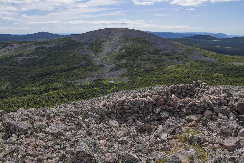
Summit of Mont Jacques-Cartier
Yesterday's pictures showed the climb to the top of the mountain, so naturally, today's images showed some of the views from the top.
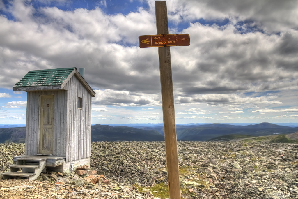
Since Mont Jacques-Cartier is one of the highest mountains in Quebec (I believe the second highest in Southern Quebec is what they brag) ... this just may be the highest toilet in Quebec.
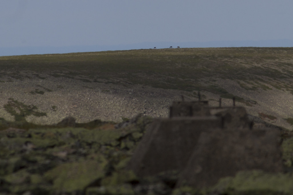
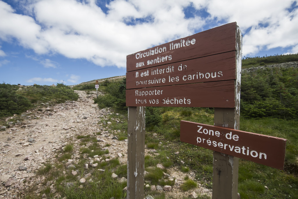
 One of the attractions that bring people to this park is the wild Caribou herd. Apparently you can get very close to them and they are almost a guaranteed view on your hikes. Well, we weren't so lucky. This was all we saw on the trip; a few on a crest in the distance only barely seen through a spotting scope.
 Of course ... the view was awesome!

One of the attractions that bring people to this park is the wild Caribou herd. Apparently you can get very close to them and they are almost a guaranteed view on your hikes. Well, we weren't so lucky. This was all we saw on the trip; a few on a crest in the distance only barely seen through a spotting scope.
Of course ... the view was awesome!
Heading up to the Summit of Mont Jacques-Cartier
On the first day of hiking during this trip, we started by heading up from the base of Mount Jacques-Cartier to the summit. For the most part this is a very well maintained, scenic and relatively easy (despite the incline) hike. About halfway up there is a lake that one can visit (and is seen in a couple of the pictures below). Below are some of the highlights from the climb up.
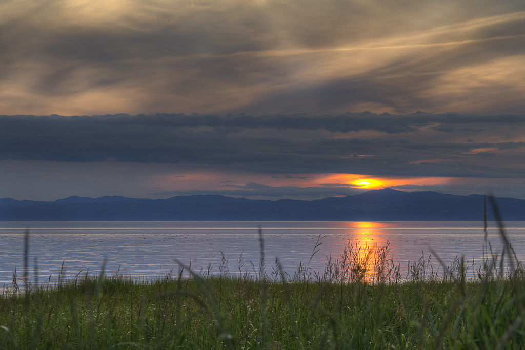
La Pocatière Sunset
Here is the first one of many to come from this summer's hiking and camping trip up to the "Parc de la last Gaspesie" in Quebec. Ironically even are starting by the end with a sunset we saw close to La Pocatière on the way back.
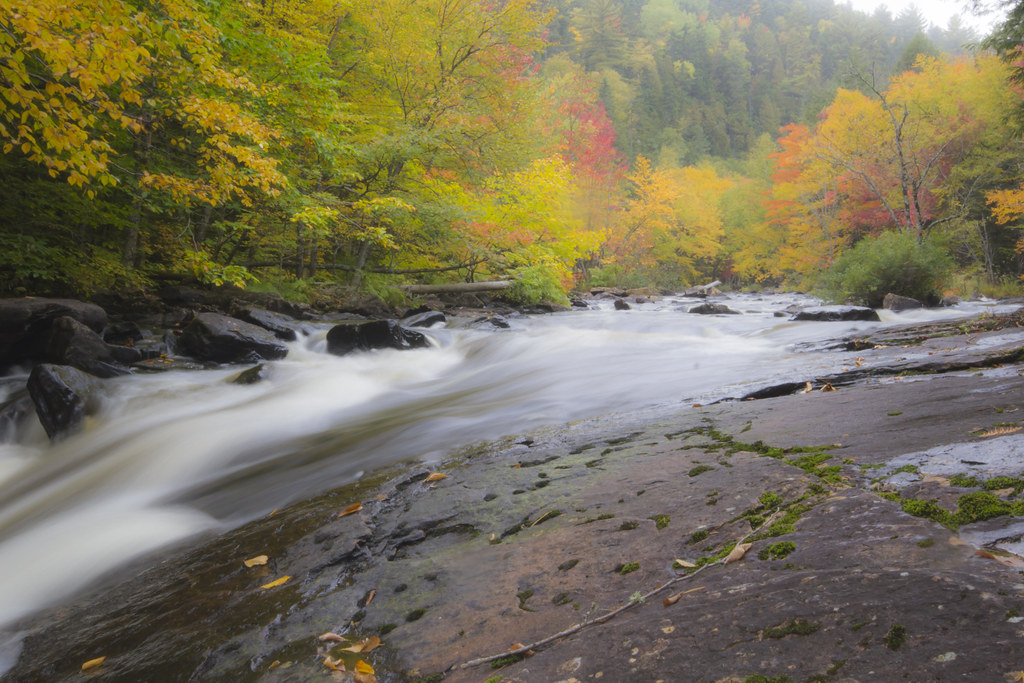
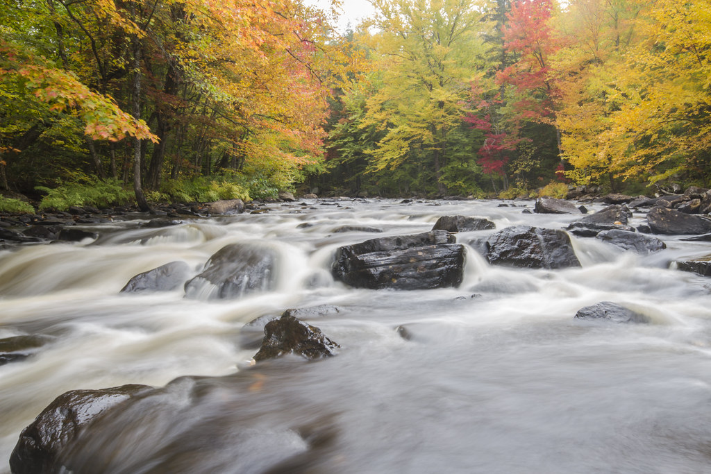
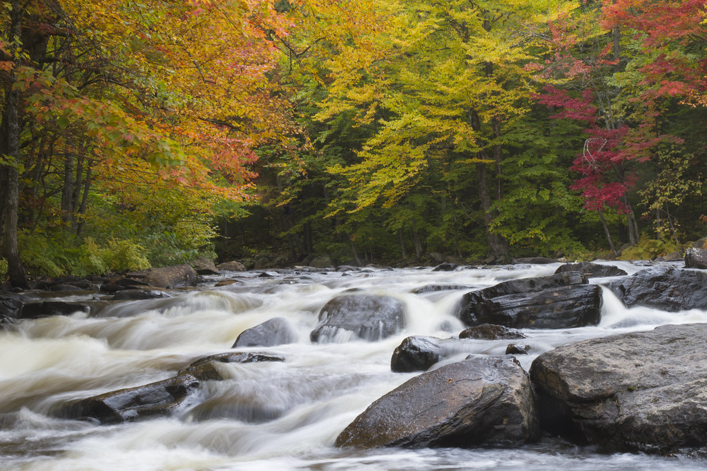
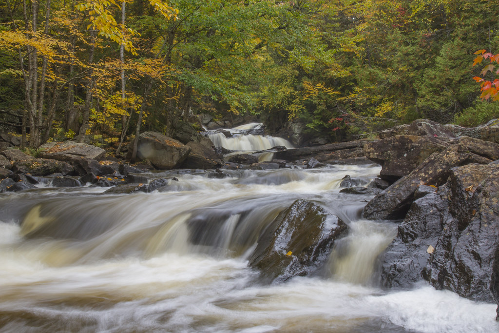
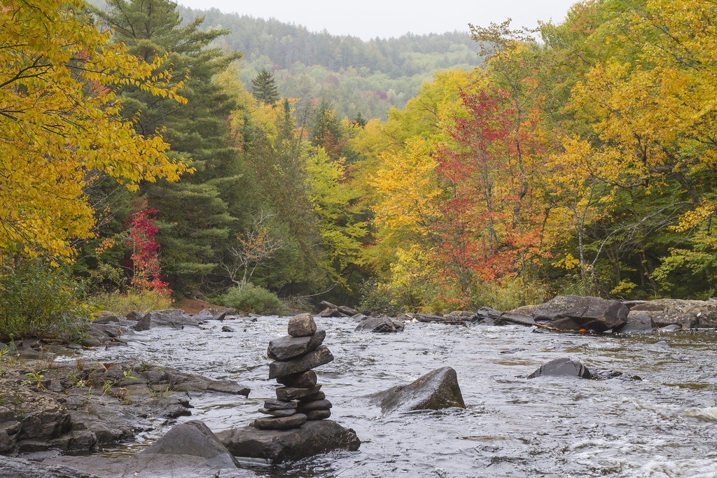
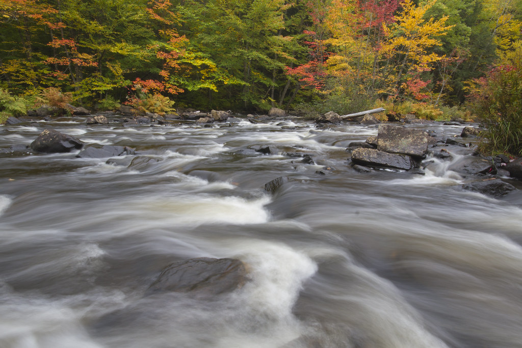
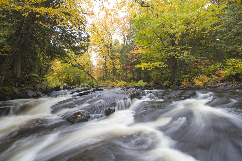
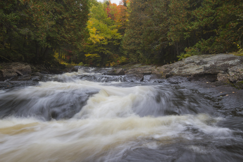
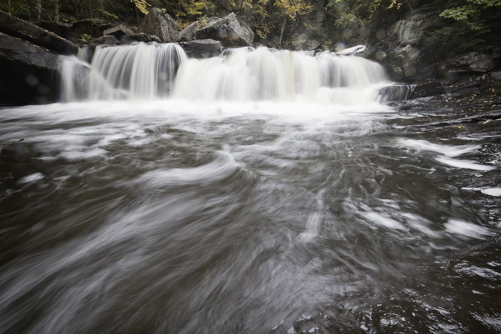
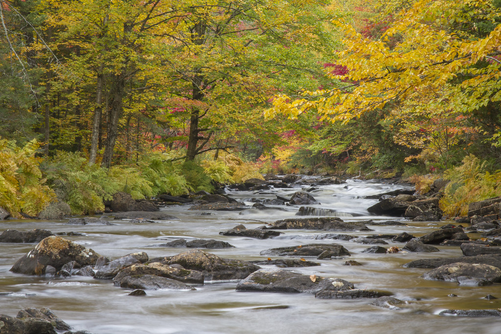
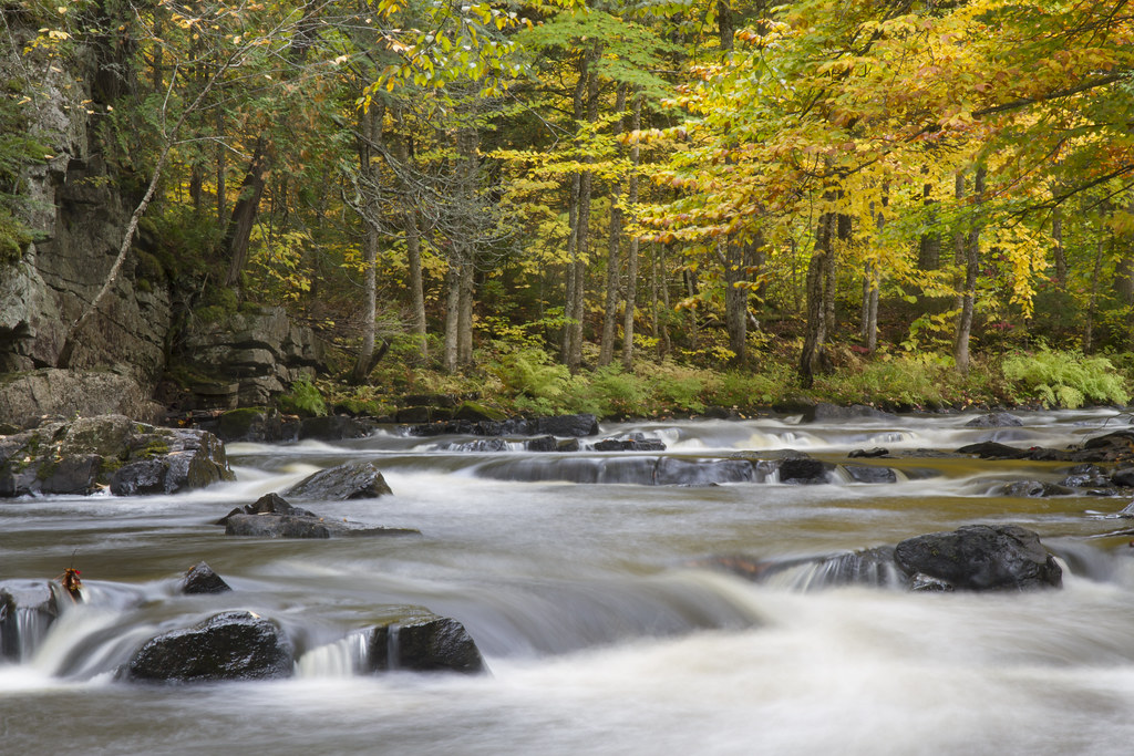
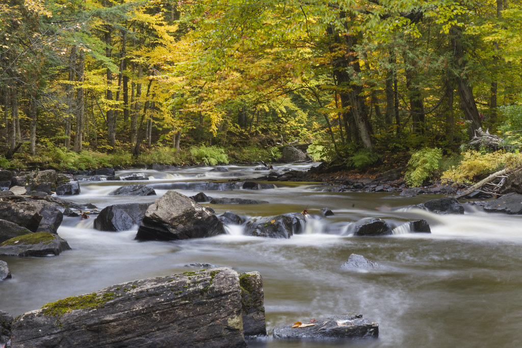
Final group from the fall stream pictures
Ok ... here are the final pictures from the fall at the cottage. We can now move on!
Pepsi and Coca Colas
In order to take a quick break from streams and falls ... how about these. These old Pepsi-Cola and Coca-Cola crates were found in the storage space underneath the cottage. I figured that they would make good subjects.